
Working ‘DX’
In this article, we’ll take a look at how we can utilise the satellite footprint to maximise our chances of working some ‘DX’ stations on FM satellites (although the same will hold true for the linear sats too).
Linear satellites tend to have a larger footprint than FM ones. The greater the footprint (that area of the globe where stations can access the satellite), the greater the potential distances that can be covered when working through them.
Although there are several websites that will show footprints, I use the Satellite Tracker app on an old iPhone 8.
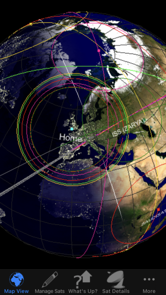
The screenshot above shows that when one of the FM satellites is directly overhead, the footprint roughly covers Scandinavia, most of Europe and just into North Africa.
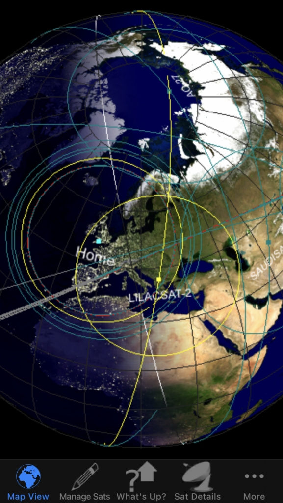
But we can extend the range of potential contacts by working the satellites when close to the horizon. Let’s take the following two examples, both using the CAS3H (Lilacsat-2) satellite to see the effect of doing this.
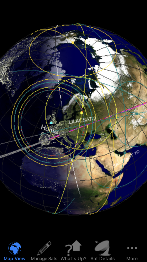
When Lilacat-2 flies directly overhead, the footprint just about covers most of Scandinavia; however during this flight it is well to the east of my position. Therefore the entire footprint is also shifted across and the current footprint easily covers all of that region and well into Russia.
You’ll also see that during an overhead pass, the footprint does not cover all of the Black Sea or Turkey, but on this pass, the Black Sea, Turkey, Georgia, Azerbaijan and the tip of Iran are all covered.
As the satellite moves across the skies, the footprint opens up new areas such as Israel, Egypt, Tunisia, Syria, Iraq and Libya.
However, working the satellites when they are low on the horizon is not easy. You really need a good station setup, excellent antennas and so on. It’s made harder as FM isn’t really classed as a good mode for working weak signals either.
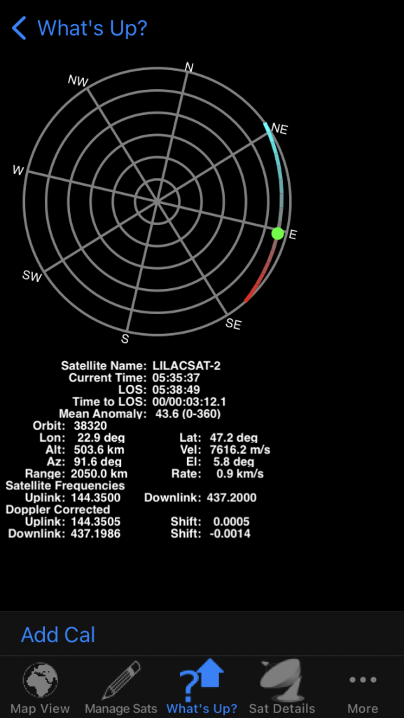
The image above shows Lilacsat-2 at it’s peak during this particular pass… and it barely reached 6 degrees above the horizon. This is pretty extreme working for an FM satellite but looking at the DX records shows it can be done; for Lilacsat-2 this stands at 5,008km between F4DXV and VE1CWJ, back in 2021 (see https://www.amsat.org/satellite-distance-records/ for more records). Even the ISS FM repeater, with it’s smaller footprint, the record stands at 4,403km!
Summary
The linear satellites do have the advantage of larger footprints and therefore greater contact distances are possible. However, by understanding the footprints of the FM satellites during low passes, it’s possible to work great distances.
You’ll need better equipment than we’ve been discussing throughout this series, and you’ll need that element of luck as well(!), but DX is entirely possible via the FM repeaters.